
omniVUE / Defence & Critical Infrastructure
See the threat.Understand the evidence.Coordinate the response.
Sensors, tracks, video and field systems in one picture, with your approved procedures built in.
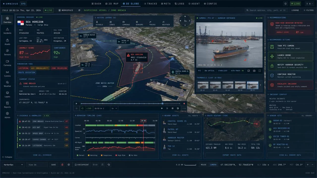
01Overview
Security teams rarely lack data. The hard part is knowing what matters, confirming it quickly and coordinating the next step across people, systems and authorities.
- For
- Defence operations, critical infrastructure, security command and remote sites
- Connects
- AIS, radar, RF, EO/IR cameras, drones, patrols and field teams, as your interfaces allow
- Sites
- Naval harbours, ports, offshore energy, airports, remote and Arctic installations
- Status
- Simulation environment, developed in Canada
02Scenario
A vessel loiters in a protected zone.
omniVUE connects the track, identity, camera evidence and nearby response assets, then lays out the approved next steps.
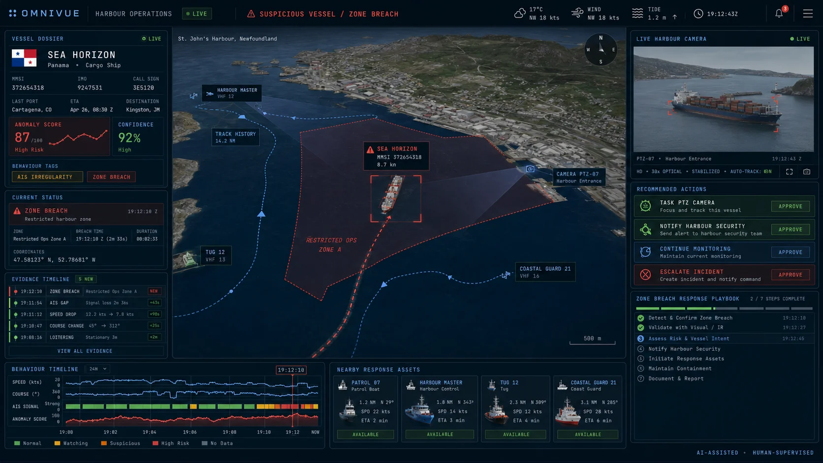
Detect
A track enters a protected zone or starts behaving outside its normal pattern.
Correlate
Identity, movement history, zones, camera evidence and sensor data come together in one incident.
Investigate
Operators task cameras, drones, vessels or other field systems for a closer look.
Understand
AI-assisted analysis explains why the event was flagged and how confident it is.
Respond
A playbook lays out notifications, escalation and actions for an authorized person to approve.
03Capabilities
Everything between the first signal and the final report.
Anomaly and zone monitoring
Route deviations, loitering and restricted-area entries surface on their own.
Multi-source verification
Each alert links to track history, camera views, detections and conditions.
Targeted reconnaissance
Point cameras and field assets at the gap in what you know.
Explainable AI assistance
Summaries that show their evidence and say how certain they are.
Controlled response
Procedures, roles and approvals move each incident forward, with a full record.
Simulation and rehearsal
Exercise threat scenarios and procedures before they are needed.
04Heritage
Built on what bridgeVUE taught us.
Before omniVUE we built bridgeVUE, an augmented reality system that made sensor data easier to read at sea. It was backed by Canada's Ocean Supercluster and tested with the Royal Canadian Navy through Innovative Solutions Canada. What we learned about sensor integration, small-target awareness and operator-centred design shaped omniVUE.
Immersive maritime awareness
Sensor data placed in the operator's view.
Tested in the real world
Trialled with the Royal Canadian Navy through Innovative Solutions Canada.
Operational intelligence
Awareness, evidence and response in one platform.
First project
Protect one critical site. Prove one decision.
Start with your existing sensors, one priority threat scenario and the people responsible for the response. We set up the whole loop, from detection to approval and review.