omniVUE Intelligence for Healthcare Operations
Predict demand. Build better schedules. Respond before the shift breaks.
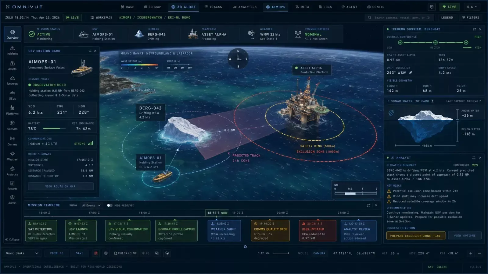
Transform disconnected observations, forecasts, offshore assets and operator procedures into a shared decision environment—from regional awareness to a human-approved ice-management response.
Offshore operationsIce management teams · Marine coordinators · HSE & readiness
01
See ice risk against
protected assets
02
forecasts and field assets
03
monitoring missions
04
operator-approved workflows
More than an iceberg map
The decision is not only where the iceberg is. It is what the operation does next.
An observation becomes operationally useful when it is connected to the assets at risk, the quality of the evidence, the resources available and the organization's approved Ice Management process.
Questions the operating picture should answer
Flagship scenario
From predicted demand to a constraint-aware roster.
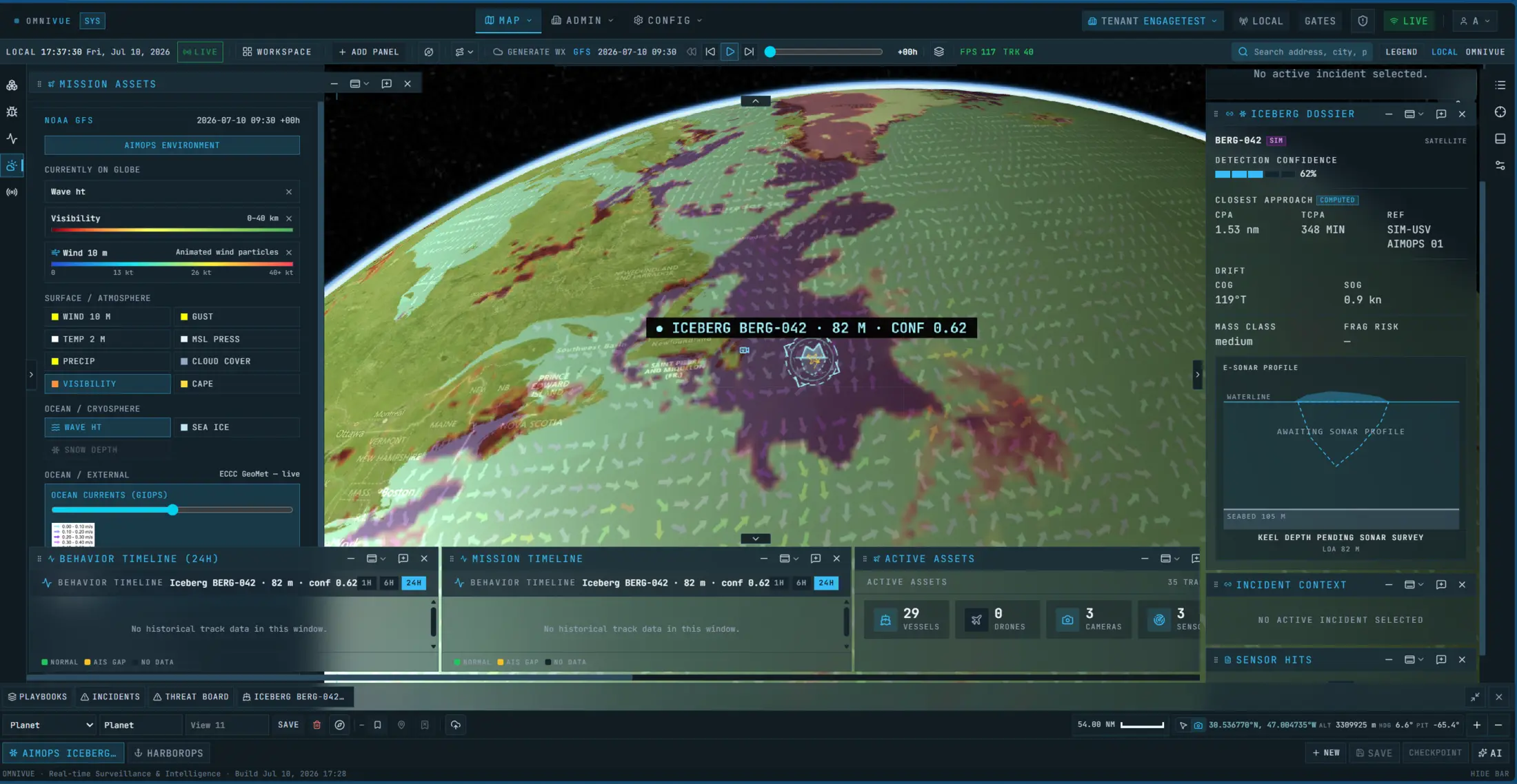
A simulated ice field approaches offshore infrastructure. omniVUE prioritizes the threats, connects monitoring assets and operating conditions, then presents the relevant response phase and tasks for authorized people to review.
Emerging capability · Simulation environment · Human-supervised
01
Assess risk to the operation
Relate drift, confidence, closest approach and time-to-action to operator-defined zones and protected infrastructure.
02
Build the roster
Generate a proposed skill mix around staffing requirements, availability, leave and local rules.
03
Coordinate better information
Focus vessels, uncrewed systems, cameras or specialist partners on the targets that require additional characterization.
04
Review the response
Apply configured Ice Management procedures, preserve the evidence and keep consequential actions subject to operator approval.
The right view at the right scale
Regional first. Mission focused. 3D when it adds meaning.
Offshore ice management spans hundreds of kilometres and highly localized decisions. omniVUE can move between those scales without forcing every task into the same interface.
01
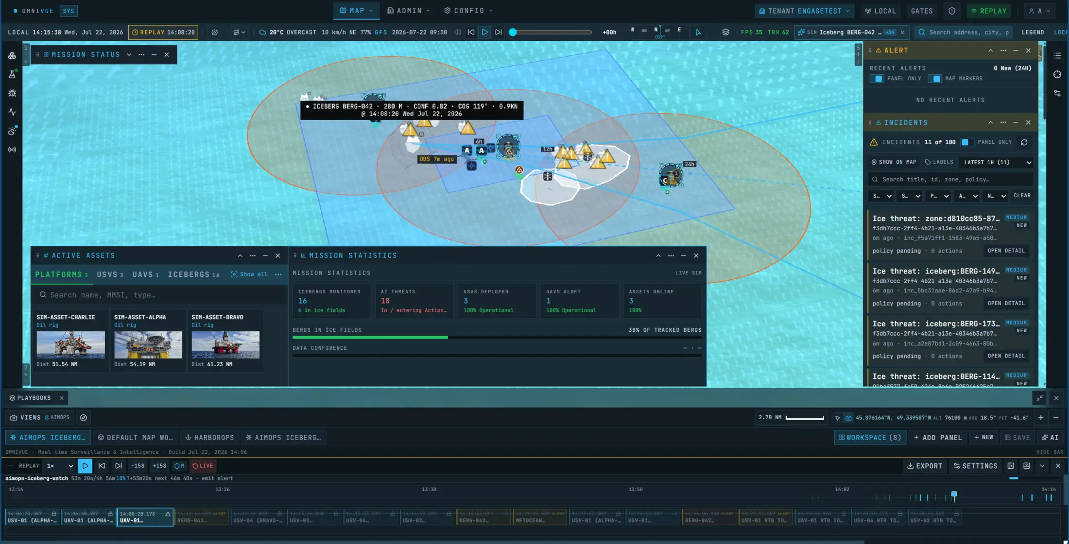
Regional awareness
A wide-area 2D operating picture for ice fields, forecast corridors, data freshness and protected offshore assets.
02
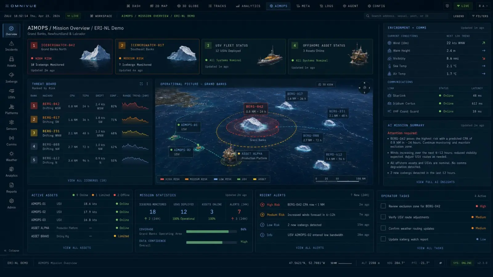
Mission coordination
A focused workspace for monitoring assets, target tracks, sensor coverage, mission status and emerging threats.
03
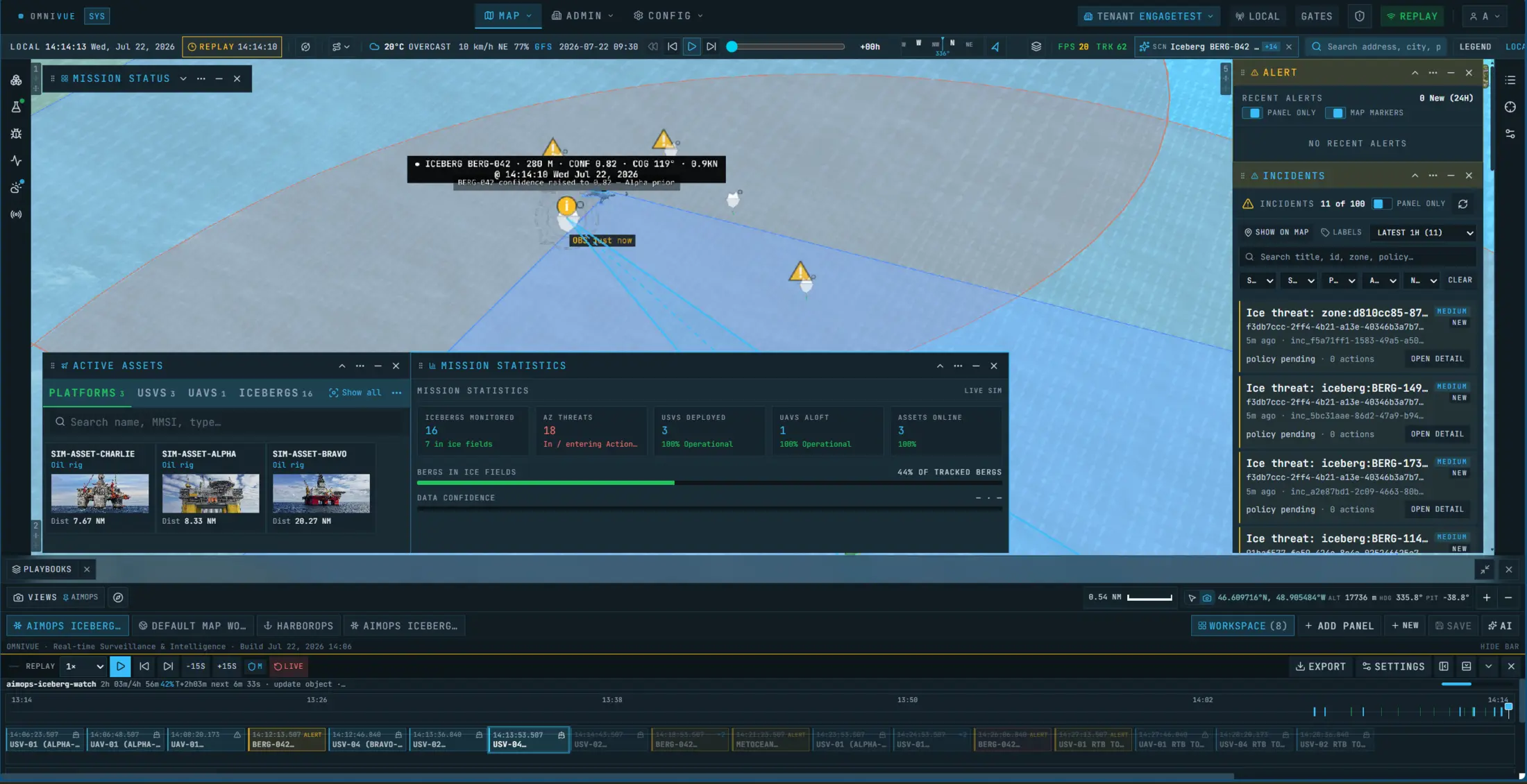
Target & asset context
Use 3D selectively when the relationship between an iceberg, a platform and monitoring geometry needs closer inspection.
A platform-agnostic operating layer
Different systems gather the evidence. omniVUE keeps the decision together.
Observation sources
See the wider environment
Available ice reports, satellite products, weather, ocean conditions, AIS and operator inputs establish the regional picture.
Monitoring assets
Close the information gap
Vessels, USVs, UAVs, cameras and other field systems can provide targeted observations through configured integrations.
Characterization partners
Understand what matters
Specialist data—such as above- and below-water characterization—can be attached to the same target and decision record.
omniVUE decision layer
Coordinate the operator response
omniVUE connects the evidence to risk, missions, procedures, approvals and an accountable operational history.
Built around the operational environment
Built for remote operations where conditions change faster than the plan.
Ice management is the clearest offshore demonstration, but the same operational pattern can support distributed assets, sparse data and coordinated response across other remote marine missions.
01
Offshore installation protection
Understand which ice hazards may affect production assets and bring the response pathway into the same operating view.
02
Field-wide ice monitoring
Coordinate multiple protected assets, ice fields and monitoring resources across a large offshore operating area.
03
Remote marine operations
Apply the same awareness and mission-coordination pattern to difficult areas with sparse infrastructure and changing conditions.
04
Seasonal readiness & rehearsal
Use simulation and replay to test data, thresholds, procedures and team response before the operating season.
Built from the North Atlantic outward
Newfoundland and Labrador is the proving ground—not the boundary.
Our offshore ice work is shaped by a region where distance, weather, limited visibility and changing conditions make coordination consequential. The platform is designed to be configured around the data, assets, zones and approved procedures of each operation.
A focused path to a credible pilot
Start with one protected asset and one decision pathway.
Define the operating area, available information, action thresholds, monitoring resources and approval process—then configure a scenario that shows the complete decision loop.

Canadian-built software for complex operational environments.
PO Box 1506, Station C
St. John's, NL
A1C 5N8
Canada
© 2026 ENGAGE CREATIVE TECHNOLOGIES